
Summer Design Update
August 27th 2026
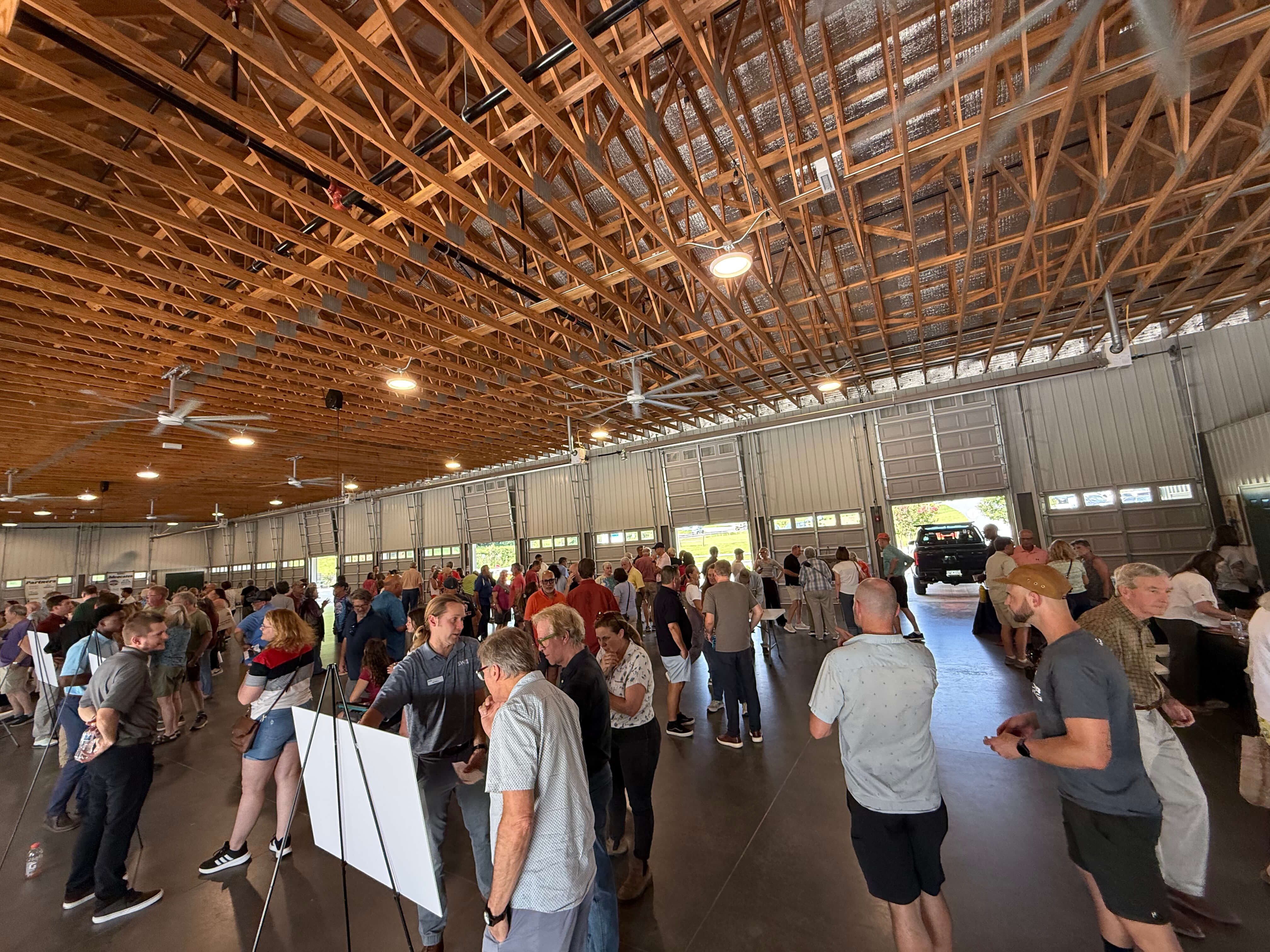
Landrum Information Session
Approximately 300 people attended the information session at the Landrum Farmers’ Market and heard from representatives of PAL, Conserving Carolina, and SeamonWhiteside, the SC trail design team, about potential trailhead locations, trail widths, and more.
“It was wonderful to spend the evening in conversation with the community about this project,” said Laura Ringo, Executive Director of PAL: Play. Advocate. Live Well. “We are committed to keeping our community informed and engaged throughout every stage of this project. We believe the best outcomes are achieved through open communication and meaningful community participation, and we encourage everyone interested in the project to join the conversation.”
Important Highlights Regarding the First Five Miles
This event highlighted the completion of the sixty percent design plans for the first five miles from the North Carolina state line south to Landrum, as well as the exciting news that permitting for this section is ahead of schedule. At this design stage, the trail route is set, locations for structures such as bridges and retaining walls are determined, and environmental impacts are resolved, while details about finishes, such as railings, landscaping, and pavements, remain to be decided. The construction timeline depends on funding and the pending outcome of a federal ARISE grant application.
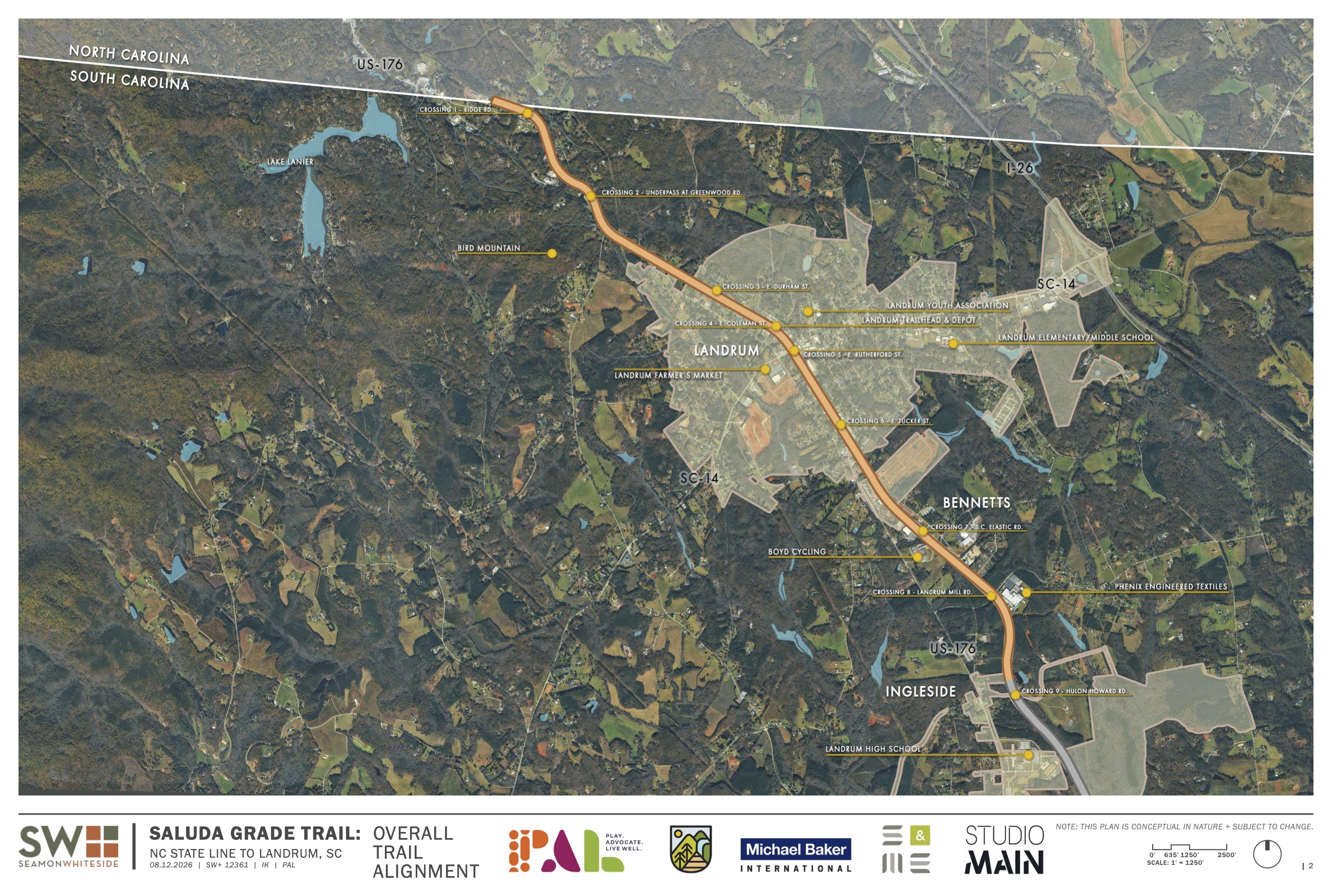
- The route: from the North Carolina state line south to Hulon Howard Road, just below Landrum. Hulon Howard Road is the end point of this segment.
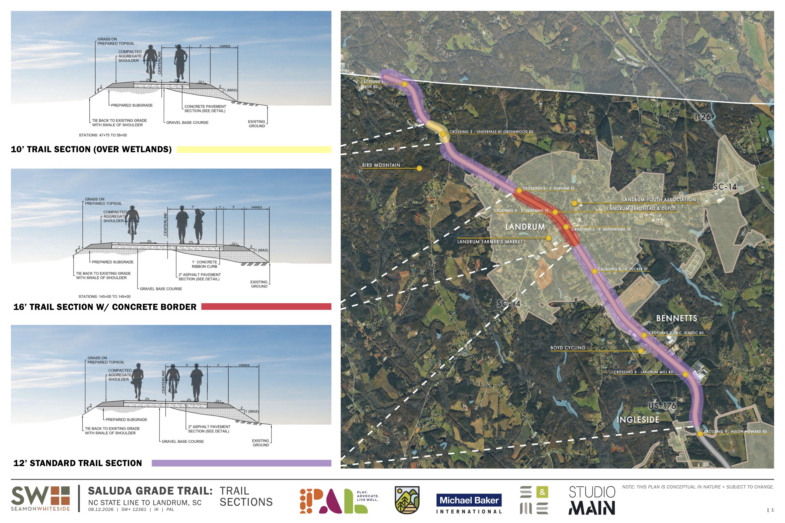
- Trail width: a twelve-foot standard trail for most of the route; a sixteen-foot section with concrete borders through downtown Landrum; and a ten-foot section where the trail crosses wetlands.
- Surface: two inches of asphalt over a gravel base, with compacted aggregate shoulders and grass beyond the edge. A section through downtown Landrum adds a one-foot concrete ribbon curb on each side.
- Proposed road crossings: nine total, including Ridge Road; Greenwood Road (which is an underpass that will not require an at-grade crossing); East Durham Street; East Coleman Street; East Rutherford Street; East Tucker Street; S.C. Elastic Road; Landrum Mill Road; and Hulon Howard Road.
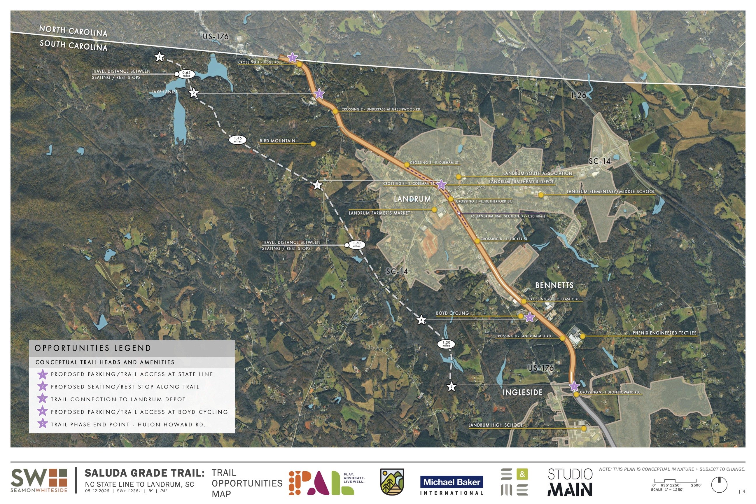
- Trailheads and parking: three are shown, all marked as proposed.
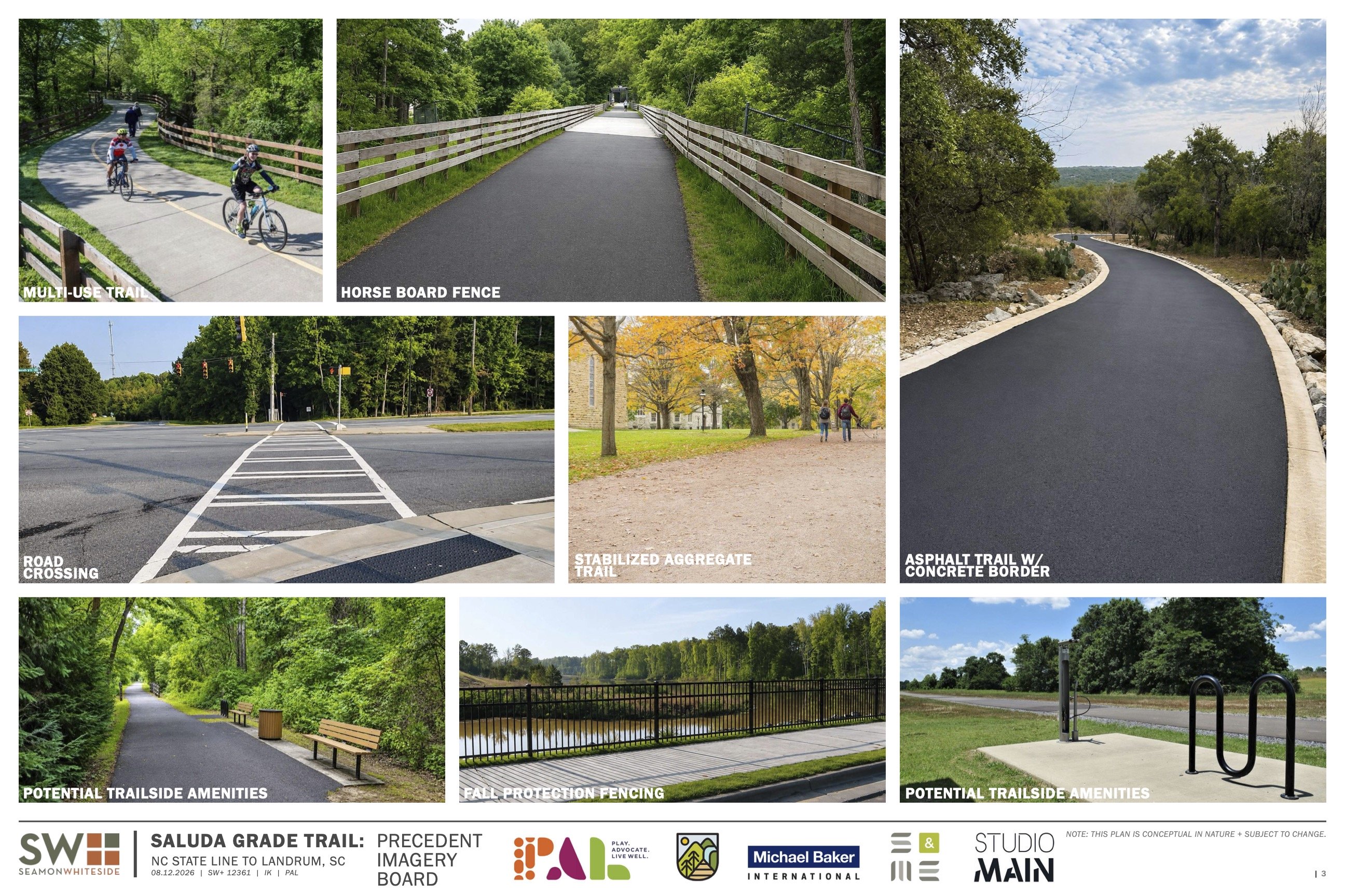
What’s Happening with Other Sections of the Trail
The U.S. Department of Housing and Urban Development (HUD) has approved the Environmental Review for this project. PAL and Conserving Carolina are actively soliciting bids until the end of August from contractors interested in removing and salvaging the track materials in both South Carolina and North Carolina.
What You Told Us
We collected questions and comments from the evening. These were the themes that came up most often:
- Timeline, funding, and phasing: when construction starts, which section comes next, and whether the phases move south in geographical order.
- Parking and trailheads: concern about the shortage of parking in downtown Landrum and interest in sites like Boyd Cycling, Landrum High School, and parcels near the state line that could add more parking options
- Road crossings and traffic: specifically, through downtown Landrum and how bicycles and pedestrians will cross safely in places where traffic is already difficult.
- Safety and emergency access: how emergency vehicles can reach someone on the trail and lessons from other trails in the region.
- Amenities: restrooms, drinking water, and lighting.
- Adjacent properties: how close landowners can build to the trail and whether access easements will be possible later.
- The North Carolina section: when it will begin, where it will begin, and how storm damage is being handled.
Stay Connected
We received questions about the Saluda Grade Trail in general, and we will update our Saluda Grade Trail FAQs page with detailed answers. Look for future blog posts that take an in-depth look at some of the questions and concerns we heard from you about the themes above. Signing up for our email newsletter will keep you updated on future announcements and events!
The planned Saluda Grade Trail will travel through scenic Upstate South Carolina into the mountains of Western North Carolina. The route passes through charming small towns including Inman, Campobello, Landrum, Tryon, Saluda, and Zirconia. PAL has partnered with Conserving Carolina to spearhead this effort. These organizations share a commitment to serving their communities and providing places for outdoor recreation.

Help Us Realize the Saluda Grade Trail
Across the United States, inactive rail lines have found new life as vibrant rail trails. Now, we have the opportunity to create a beautiful new trail along the historic Saluda Grade rail line!

A new rail trail that travels from the rolling countryside of Upstate South Carolina, through historic and vibrant small towns, and into the spectacular mountain scenery of Western North Carolina.
© 2026 Saluda Grade Trail Conservancy. All Rights Reserved | Privacy & Legal |
Site by: ALINE, A Marketing Company